Metadata for Postal Code Areas
Identification
- File Name
- RegPostalCodes
- Feature Dataset
- Regulatory Areas
- Ownership
-
District of North Vancouver
355 West Queens Road, North Vancouver, BC, Canada, V7N 4N5
Spatial
- Extents
-
- Coverage
-
West:
Not Applicable
East: Not Applicable
South: Not Applicable
North: Not Applicable - Coordinate System
- Not Applicable
- Projection
- Not Applicable
File Properties
- Data Type
- Feature Class
- Data Format
- ESRI Enterprise SDE
- Geometry Type
- Not Applicable
- Topology
- Not Applicable
- Spatial Index
- Not Applicable
- Linear Referencing
- Not Applicable
History
- Date Posted to GIS:
- 2007
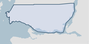
- 2007: This feature class was created by digitizing the forward sortation area polygons from a small scale and very generalized map supplied by Canada Post.
Quality
- Accuracy
-
- Digitized from a softcopy map. Boundaries are generalized and derived from textual and spatial descriptions from Canada Post maps.
- Spatial information is collected and entered using a compromised method applicable to this dataset.
- Spatial information is moderately accurate and considerable improvements could be made.
- Where multiple collection/entry methods, the more accurate method is not predominant throughout this dataset.
- Completeness
-
- Spatial information is known to be complete, expected to be complete or very close to complete.
Maintenance
GIS department contacts Canada Post and asks if there is a replacement for this data set.
Supporting Documentation
- Data Dictionary
- Not Applicable
- Relationships
- Not Applicable
- Rights
- Terms and Conditions of Use