Metadata for Official Community Plan Urban Boundary
Identification
- File Name
- RegOCPUrbanContainment
- Feature Dataset
- Regulatory Areas
- Ownership
-
District of North Vancouver
355 West Queens Road, North Vancouver, BC, Canada, V7N 4N5
Spatial
- Extents
-
- Coverage
-
West:
Not Applicable
East: Not Applicable
South: Not Applicable
North: Not Applicable - Coordinate System
- Not Applicable
- Projection
- Not Applicable
File Properties
- Data Type
- Feature Class
- Data Format
- ESRI Enterprise SDE
- Geometry Type
- Not Applicable
- Topology
- Not Applicable
- Spatial Index
- Not Applicable
- Linear Referencing
- Not Applicable
History
- Date Posted to GIS:
- 2011
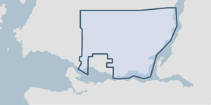
- 2011: The Official Community Plan Urban Containment Boundary was defined by the Planning Department with input from Metro Vancouver through development of the Regional Growth Strategy. Planning department staff oversaw the accuracy of the digital compilation effort.
Quality
- Accuracy
- Completeness
-
- Spatial information is known to be complete, expected to be complete or very close to complete.
Maintenance
The Clerks or Planning department submit a council adopted amendment (a bylaw) to the GIS department. The OCP Urban Containment Boundary is adjusted in the GIS as required. Amendments must be ratified by Metro Vancouver as they would in turn alter Metro's Regional Growth Strategy.
Supporting Documentation
- Data Dictionary
- Not Applicable
- Relationships
- Not Applicable
- Rights
- Terms and Conditions of Use