Metadata for Boundary
Identification
- File Name
- RegBoundary
- Feature Dataset
- Regulatory Areas
- Ownership
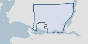
-
District of North Vancouver
355 West Queens Road, North Vancouver, BC, Canada, V7N 4N5
Spatial
- Extents
-
- Coverage
-
West:
Not Applicable
East: Not Applicable
South: Not Applicable
North: Not Applicable - Coordinate System
- Not Applicable
- Projection
- Not Applicable
File Properties
- Data Type
- Feature Class
- Data Format
- ESRI Enterprise SDE
- Geometry Type
- Not Applicable
- Topology
- Not Applicable
- Spatial Index
- Not Applicable
- Linear Referencing
- Not Applicable
History
- Date Posted to GIS:
- 1998
- 1988: An electronic copy of parcels was acquired from Terasen (then called BC Gas) in the late 1980's. The spatial accuracy of the parcel pins was approximately 10 to 50 cm on average as property pins were not entered using coordinate geometry. No alpine parcels existed, only parcels in the developed portion of the District of North Vancouver.
- 1996: The parcels in the alpine region were added by metes and bounds descriptions due to lack of first order survey monuments in that region. At this time all District Lots were now entered into the GIS.
- 1998: By interpreting the metes and bounds description from Bylaw #601 and locating property pins for the necessary District Lots, an electronic boundary was created in the GIS.
- 2006: The metes and bounds description of the bylaw was again interpreted to double check the accuracy of the District's boundary.
Quality
- Accuracy
-
- District lot property pins in the urban region are +/- 0.40m. Alpine area district lots can deviate by (+/- 8.00m).
- Spatial information is collected and entered using the best method applicable to this dataset.
- Spatial information is higly accurate and reasonably the best it can be.
- Where multiple collection/entry methods, the more accurate method is predominant throughout this dataset.
- Completeness
-
- Spatial information is known to be complete, expected to be complete or very close to complete.
Maintenance
The Land Titles Office submits legal plans to the GIS department. Boundaries are updated in the GIS as required.
Supporting Documentation
- Data Dictionary
- Not Applicable
- Relationships
- Not Applicable
- Rights
- Terms and Conditions of Use