Metadata for Debris Fans
Identification
- File Name
- EnvDebrisFan
- Feature Dataset
- Environmental Management
- Ownership
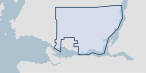
-
District of North Vancouver
355 West Queens Road, North Vancouver, BC, Canada, V7N 4N5
Spatial
- Extents
-
- Coverage
-
West:
Not Applicable
East: Not Applicable
South: Not Applicable
North: Not Applicable - Coordinate System
- Not Applicable
- Projection
- Not Applicable
File Properties
- Data Type
- Feature Class
- Data Format
- ESRI Enterprise SDE
- Geometry Type
- Not Applicable
- Topology
- Not Applicable
- Spatial Index
- Not Applicable
- Linear Referencing
- Not Applicable
History
- Date Posted to GIS:
- 2005
- 1995: The initial alluvial fan information was collected by KWL and Assoc in 1995. The resulting ESRI shapefile was then submitted to the DNV depicting the location of these geographic features.
- 2005: Debris fans were assessed for their potential threat to public safety. KWL and Associates conducted an analytical study on the potential hazard posed by the debris fans. The results of the study are stored in the feature class called SafDebrisFlowPotential.
Quality
- Accuracy
- Completeness
-
- Spatial information is known to be complete, expected to be complete or very close to complete.
Maintenance
A consultant or other department submits a marked up map or an electronic file (most commonly a GIS file format) to the GIS department. Debris fan information is updated accordingly.
Supporting Documentation
- Data Dictionary
- Not Applicable
- Relationships
- Not Applicable
- Rights
- Terms and Conditions of Use