Metadata for Fire Response Zones
Identification
- File Name
- EmgFireZones
- Feature Dataset
- Emergency
- Ownership
-
District of North Vancouver
355 West Queens Road, North Vancouver, BC, Canada, V7N 4N5
Spatial
- Extents
-
- Coverage
-
West:
Not Applicable
East: Not Applicable
South: Not Applicable
North: Not Applicable - Coordinate System
- Not Applicable
- Projection
- Not Applicable
File Properties
- Data Type
- Feature Class
- Data Format
- ESRI Enterprise SDE
- Geometry Type
- Not Applicable
- Topology
- Not Applicable
- Spatial Index
- Not Applicable
- Linear Referencing
- Not Applicable
History
- Date Posted to GIS:
- 2004
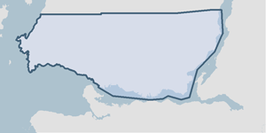
- 2004: Fire zones were originally created to support the FDM Fire Dispatch system. The zones were digitized from maps supplied from all three North Shore Fire departments.
- 2007: The zone ID was used to aid in dispatching emergency vehicles to a certain location. However, since 2007 City of Surrey now dispatches for North Vancouver and it is unknown whether these Fire Zones are still utilized.
Quality
- Accuracy
-
- Zones were defined by DNV Fire department.
- Spatial information is collected and entered using the best method applicable to this dataset.
- Spatial information is higly accurate and reasonably the best it can be.
- Where multiple collection/entry methods, the more accurate method is predominant throughout this dataset.
- Completeness
-
- Spatial information is known to be complete, expected to be complete or very close to complete.
Maintenance
The Fire department submits marked up maps to the GIS department. Fire response zones are updated accordingly.
Supporting Documentation
- Data Dictionary
- Not Applicable
- Relationships
- Not Applicable
- Rights
- Terms and Conditions of Use