Metadata for Tidal Flats
Identification
- File Name
- HydTidalFlat
- Feature Dataset
- Hydrology
- Ownership
-
District of North Vancouver
355 West Queens Road, North Vancouver, BC, Canada, V7N 4N5
Spatial
- Extents
-
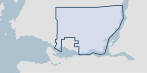
- Coverage
-
West:
497077.62 m
East: 504521.91 m
South: 5460375.09 m
North: 5463085.79 m - Coordinate System
- GCS North American 1983
- Projection
- NAD 1983 UTM Zone 10N
File Properties
- Data Type
- Feature Class
- Data Format
- ESRI Enterprise SDE
- Geometry Type
- Polygon
- Topology
- False
- Spatial Index
- True
- Linear Referencing
- False
History
- Date Posted to GIS:
- 2005
- 2003: Originally, tidal flat information was entered into the GIS by heads-up digitizing 2003 orthoimagery.
- 2007: This dataset has been updated by digitizing the latest orthoimagery.
Quality
- Accuracy
-
- Locations of tidal flats is somewhat subjective. Polygons were heads-up digitized.
- Spatial information is collected and entered using the next best method applicable to this dataset.
- Spatial information is very accurate but could be improved using a better collection technique.
- Where multiple collection/entry methods, the more accurate method is predominant throughout this dataset.
- Completeness
-
- Spatial information is known to be complete, expected to be complete or very close to complete.
Maintenance
The GIS department digitizes any updates into this dataset from the most recent orthoimagery.
Supporting Documentation
- Data Dictionary
- Not Applicable
- Relationships
- Not Applicable
- Rights
- Terms and Conditions of Use